
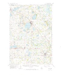
1958 Map of Buffalo
USGS Topo · Published 1959About this map
The glacial landscape of Wright County is defined here by a dense cluster of lakes and small agricultural centers in the late 1950s. The city of Buffalo sits at the eastern edge of Buffalo Lake, serving as a central hub for the surrounding townships of Chatham and Marysville. The landscape is dotted with numerous small-district schools and rural parish churches, such as Swedesburg Ch and St Marys Ch, reflecting the deep-rooted immigrant settlement patterns of the region.
Find a feature on this map
109 named features on this map. Tap any name to fly to it.
Don’t see what you’re looking for? This feature index may not catch every label — zoom into the map to look around manually.
Map Details
Editions of this 1958 Buffalo Map
2 editions found
Other maps of this area

1905 · Minnetonka
USGS Topo · 1:62,500

1907 · Minnetonka
USGS Topo · 1:62,500

1909 · Rockford
USGS Topo · 1:62,500

1951 · Annandale
USGS Topo · 1:62,500

1953 · Saint Paul
USGS Topo · 1:250,000

1953 · New Ulm
USGS Topo · 1:250,000

1953 · Saint Cloud
USGS Topo · 1:250,000

1953 · Stillwater
USGS Topo · 1:250,000

1955 · Stillwater
USGS Topo · 1:250,000

1957 · Saint Cloud
USGS Topo · 1:250,000