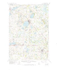
1958 Map of Buffalo
USGS Topo · Published 1972About this map
Buffalo Lake and Lake Pulaski dominate the central landscape of this Wright County region, anchoring the growing community of Buffalo. The late 1950s terrain is a dense network of rural school districts and parish cemeteries, reflecting a well-established agricultural society. Small schoolhouses like Mission Center Sch and Section Eight Sch are scattered across the townships, while the Soo Line and Great Northern railroads provide vital links between the dairy farms and larger markets.
Find a feature on this map
104 named features on this map. Tap any name to fly to it.
Don’t see what you’re looking for? This feature index may not catch every label — zoom into the map to look around manually.
Map Details
Editions of this 1958 Buffalo Map
2 editions found

Other maps of this area

1905 · Minnetonka
USGS Topo · 1:62,500

1907 · Minnetonka
USGS Topo · 1:62,500

1909 · Rockford
USGS Topo · 1:62,500

1951 · Annandale
USGS Topo · 1:62,500

1953 · Saint Paul
USGS Topo · 1:250,000

1953 · New Ulm
USGS Topo · 1:250,000

1953 · Saint Cloud
USGS Topo · 1:250,000

1953 · Stillwater
USGS Topo · 1:250,000

1955 · Stillwater
USGS Topo · 1:250,000

1957 · Saint Cloud
USGS Topo · 1:250,000