Loading...
Loading map...2021 Map of Montreal
USGS Topo · Published 2021About this map
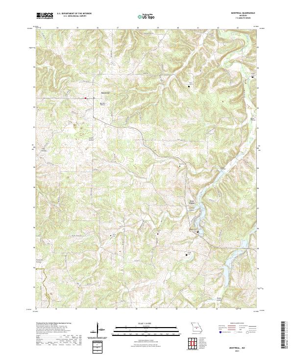
Montreal and Wet Glaize anchor this Ozark Plateau landscape, where the headwaters of Wet Glaize Cr and Mill Cr carve a complex series of hollows through the Missouri countryside. The topography is defined by named valleys such as Barnett Hollow, Sellers Hollow, and Traw Hollow, which have historically dictated the placement of homesteads and connecting routes like State Hwy BB and Brown School Rd.
Find a feature on this map
66 named features on this map. Tap any name to fly to it.
Don’t see what you’re looking for? This feature index may not catch every label — zoom into the map to look around manually.
Map Details
Date Portrayed2021
Date Published2021
PublisherU.S. Geological Survey
Map TypeTopographic
Scale1:24000
Physical Dimensions24 x 29 inches
Editions of this 2021 Montreal Map
This is the sole edition of this map. No revisions or reprints were ever made.
Historical Maps of Wet Glaize Through Time
Featured Locations
Source Details
SourceU.S. Geological Survey
CopyrightPublic Domain