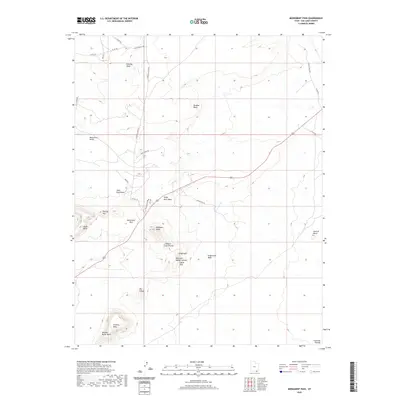
2020 Map of Monument Pass
USGS Topo · Published 2020About this map
Monument Valley defines this portion of the Colorado Plateau in San Juan County, where high sandstone formations dominate the drainage basins. The landscape is characterized by prominent buttes and mesas, including the massive Douglas Mesa to the north and the cluster containing Brighams Tomb, King-on-his-Throne, and Stagecoach. These features overlook a network of ephemeral watercourses such as Douglas Wash and Train Rock Wash.
Find a feature on this map
35 named features on this map. Tap any name to fly to it.
Don’t see what you’re looking for? This feature index may not catch every label — zoom into the map to look around manually.
Map Details
Editions of this 2020 Monument Pass Map
This is the sole edition of this map. No revisions or reprints were ever made.
Other maps of this area

1883 · Marsh Pass
USGS Topo · 1:250,000

1886 · Henry Mountains
USGS Topo · 1:250,000

1886 · Abajo
USGS Topo · 1:250,000

1892 · Marsh Pass
USGS Topo · 1:250,000

1892 · Abajo
USGS Topo · 1:250,000

1892 · Henry Mountains
USGS Topo · 1:250,000

1892 · Canyon De Chelly
USGS Topo · 1:250,000

1893 · Abajo
USGS Topo · 1:250,000

1952 · Clay Hills 4 SW
USGS Topo · 1:24,000

1952 · Agathla Peak 1 NW
USGS Topo · 1:24,000