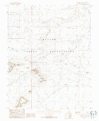
1988 Map of Monument Pass
USGS Topo · Published 1988About this map
Navajo Indian Reservation lands dominate this late 20th-century landscape, characterized by the distinct geologic formations of the American Southwest. The terrain is marked by isolated features with evocative names like King-on-his-Throne, Bear and Rabbit, and Castle Rock, which rise above the surrounding desert floor. This 1988 provisional survey documents the area's natural landmarks and drainage systems, including Halgaitoh Wash and Douglas Wash, alongside significant elevations such as Sentinel Mesa and Eagle Mesa. The presence of the Redlands Viewpoint and the naming of Monument Pass indicate the area's significance for navigation and sightseeing within the reservation boundaries. These topographic details capture a specific moment before further development or landscape shifts, providing an essential record for those studying the physical geography of San Juan County.
Find a feature on this map
19 named features on this map. Tap any name to fly to it.
Don’t see what you’re looking for? This feature index may not catch every label — zoom into the map to look around manually.
Map Details
Editions of this 1988 Monument Pass Map
This is the sole edition of this map. No revisions or reprints were ever made.
Other maps of this area

1883 · Marsh Pass
USGS Topo · 1:250,000

1886 · Henry Mountains
USGS Topo · 1:250,000

1886 · Abajo
USGS Topo · 1:250,000

1892 · Marsh Pass
USGS Topo · 1:250,000

1892 · Abajo
USGS Topo · 1:250,000

1892 · Henry Mountains
USGS Topo · 1:250,000

1892 · Canyon De Chelly
USGS Topo · 1:250,000

1893 · Abajo
USGS Topo · 1:250,000

1952 · Clay Hills 4 SW
USGS Topo · 1:24,000

1952 · Agathla Peak 1 NW
USGS Topo · 1:24,000