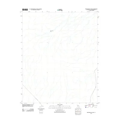
2012 Map of Monumental Pass
USGS Topo · Published 2012About this map
Monumental Pass anchors this remote desert landscape in eastern San Bernardino County, marking a natural passage through the arid terrain. The map depicts a territory largely defined by its drainage patterns and vast open spaces, with minimal human infrastructure visible beyond the southeast corner. A single Utility Access Rd cuts across the southwestern corner, reflecting the industrial utility corridors that traverse the California desert. The eastern edge of the quadrangle shows the approach of a primary roadway, suggesting the transition from the isolated interior towards the regional hub of Needles. This survey captures the topographical character of the area before modern expansion or significant desert development altered the fundamental layout of the land.
Find a feature on this map
2 named features on this map. Tap any name to fly to it.
Don’t see what you’re looking for? This feature index may not catch every label — zoom into the map to look around manually.
Map Details
Editions of this 2012 Monumental Pass Map
This is the sole edition of this map. No revisions or reprints were ever made.
Other maps of this area

1903 · Needles
USGS Topo · 1:125,000

1904 · Needles Special
USGS Topo · 1:125,000

1943 · Center Hills
USGS Topo · 1:62,500

1943 · Bannock
USGS Topo · 1:62,500

1950 · Sawtooth Range
USGS Topo · 1:62,500

1950 · Needles
USGS Topo · 1:62,500

1951 · Sawtooth Range
USGS Topo · 1:62,500

1952 · Needles
USGS Topo · 1:62,500

1954 · Needles
USGS Topo · 1:250,000

1956 · Needles
USGS Topo · 1:250,000