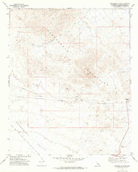
1971 Map of Monumental Pass
USGS Topo · Published 1973About this map
Sacramento Mountains dominate this 1970s topographic record, where the terrain transitions sharply into the Chemehuevi Valley to the south. This arid landscape is defined by its transit corridors rather than permanent settlements, featuring the notable Monumental Pass and Lobecks Pass. The presence of a high-altitude Radio Tower and various Jeep Trails suggests a mid-century infrastructure focused on communication and utility maintenance rather than habitation.
Find a feature on this map
14 named features on this map. Tap any name to fly to it.
Don’t see what you’re looking for? This feature index may not catch every label — zoom into the map to look around manually.
Map Details
Editions of this 1971 Monumental Pass Map
This is the sole edition of this map. No revisions or reprints were ever made.
Other maps of this area

1903 · Needles
USGS Topo · 1:125,000

1904 · Needles Special
USGS Topo · 1:125,000

1943 · Center Hills
USGS Topo · 1:62,500

1943 · Bannock
USGS Topo · 1:62,500

1950 · Sawtooth Range
USGS Topo · 1:62,500

1950 · Needles
USGS Topo · 1:62,500

1951 · Sawtooth Range
USGS Topo · 1:62,500

1952 · Needles
USGS Topo · 1:62,500

1954 · Needles
USGS Topo · 1:250,000

1956 · Needles
USGS Topo · 1:250,000