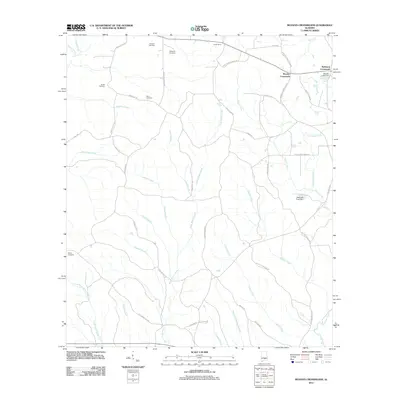
2011 Map of Moodys Crossroads
USGS Topo · Published 2011About this map
Moodys Crossroads and Robinson Crossroads anchor this rural landscape in Crenshaw County, where a network of country roads connects isolated homesteads and family burial grounds. The terrain is defined by a dense web of waterways, including the winding course of Pigeon Creek in the northwest and Patsaliga Creek in the southeast. Numerous cemeteries like Howard Cemetery, Bedgood Cemetery, and Shiloh Cemetery are scattered throughout the quadrangle, offering essential locations for genealogical research. The map documents the local hydrology with features such as Moody Lake Dam and Keelough Pond Dam, alongside many named branches and creeks like Hard Labor Creek and Panther Creek. Named roads, including Saint James Church Rd and Old Spring Hill Rd, provide a modern framework for tracing historical land use and early 21st-century settlement patterns in this part of southern Alabama.
Find a feature on this map
56 named features on this map. Tap any name to fly to it.
Don’t see what you’re looking for? This feature index may not catch every label — zoom into the map to look around manually.
Map Details
Editions of this 2011 Moodys Crossroads Map
This is the sole edition of this map. No revisions or reprints were ever made.
Other maps of this area

1953 · Andalusia
USGS Topo · 1:250,000

1957 · Andalusia
USGS Topo · 1:250,000

1971 · Industry
USGS Topo · 1:24,000

1971 · Luverne
USGS Topo · 1:24,000

1971 · Brantley
USGS Topo · 1:24,000

1971 · Fullers Crossroads
USGS Topo · 1:24,000

1971 · Pigeon Creek
USGS Topo · 1:24,000

1971 · Honoraville
USGS Topo · 1:24,000

1971 · Leon
USGS Topo · 1:24,000

1971 · Moodys Crossroads
USGS Topo · 1:24,000