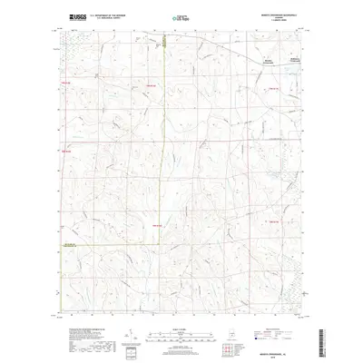
2018 Map of Moodys Crossroads
USGS Topo · Published 2018About this map
The borderlands of Butler Co and Crenshaw Co are defined by an intricate network of waterways and rural intersections. In the northeast, Moodys Crossroads and Robinson Crossroads anchor the landscape, while smaller family and community landmarks like Wren Cem and Howard Cem offer clues for genealogical research. The terrain is marked by significant hydrological features including Pigeon Creek Swamp in the northwest and Moodys Lake near the edge of the survey. Numerous named branches and creeks, such as Hard Labor Cr, Piney Woods Cr, and Patsaliga Creek, carve through the region, reflecting a landscape where drainage and elevation dictate the paths of rural routes like Old Springhill Rd and Cooks Stand Rd. This map captures a quintessential piece of the Alabama coastal plain's rural infrastructure.
Find a feature on this map
77 named features on this map. Tap any name to fly to it.
Don’t see what you’re looking for? This feature index may not catch every label — zoom into the map to look around manually.
Map Details
Editions of this 2018 Moodys Crossroads Map
This is the sole edition of this map. No revisions or reprints were ever made.
Other maps of this area

1953 · Andalusia
USGS Topo · 1:250,000

1957 · Andalusia
USGS Topo · 1:250,000

1971 · Industry
USGS Topo · 1:24,000

1971 · Luverne
USGS Topo · 1:24,000

1971 · Brantley
USGS Topo · 1:24,000

1971 · Fullers Crossroads
USGS Topo · 1:24,000

1971 · Pigeon Creek
USGS Topo · 1:24,000

1971 · Honoraville
USGS Topo · 1:24,000

1971 · Leon
USGS Topo · 1:24,000

1971 · Moodys Crossroads
USGS Topo · 1:24,000