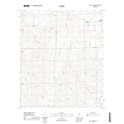
2020 Map of Moodys Crossroads
USGS Topo · Published 2020About this map
Moodys Crossroads and Robinson Crossroads anchor the landscape of this 2020 survey, which details a rural stretch along the border of Butler and Crenshaw Counties. The terrain is defined by an intricate network of waterways, including Pigeon Creek Swamp in the northwest and Patsaliga Creek in the southeast. Numerous small tributaries such as Hard Labor Cr, Horse Creek, and Indian Cr carve through the countryside, illustrating the complex drainage patterns of this corner of Alabama. Local history is preserved in several family-named burial sites, including Howard Cem, Bedgood Cem, Butler Cem, and Wren Cem, which are tucked away along country roads like Bedgood RD and Cedar Cut RD. This modern topographic study shows the enduring rural character of the region, where land use remains closely tied to the natural watercourses and the established road network connecting these historic crossroads.
Find a feature on this map
72 named features on this map. Tap any name to fly to it.
Don’t see what you’re looking for? This feature index may not catch every label — zoom into the map to look around manually.
Map Details
Editions of this 2020 Moodys Crossroads Map
This is the sole edition of this map. No revisions or reprints were ever made.
Other maps of this area

1953 · Andalusia
USGS Topo · 1:250,000

1957 · Andalusia
USGS Topo · 1:250,000

1971 · Industry
USGS Topo · 1:24,000

1971 · Luverne
USGS Topo · 1:24,000

1971 · Brantley
USGS Topo · 1:24,000

1971 · Fullers Crossroads
USGS Topo · 1:24,000

1971 · Pigeon Creek
USGS Topo · 1:24,000

1971 · Honoraville
USGS Topo · 1:24,000

1971 · Leon
USGS Topo · 1:24,000

1971 · Moodys Crossroads
USGS Topo · 1:24,000