2022 Map of Moore
USGS Topo · Published 2022About this map
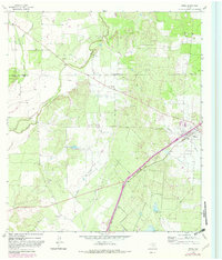
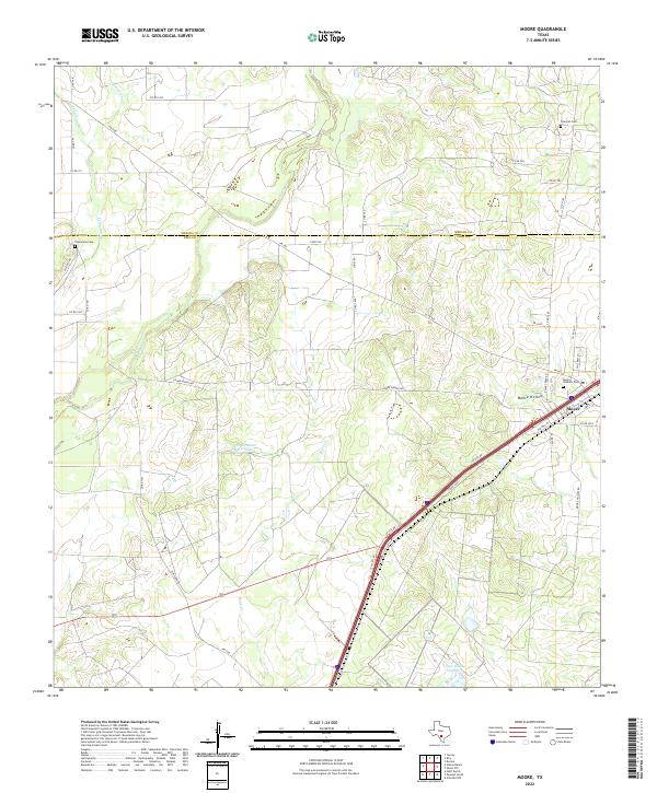
The community of Moore sits at the junction of modern infrastructure and rural tradition along the border of Medina and Frio Counties. The landscape is defined by the winding paths of Tehuacana Creek and Hondo Creek, which drain toward the south through the local depression known as Moore Hollow. This recent survey illustrates the enduring presence of local families through meticulously mapped landmarks like the Tehuacana Cemetery in the west and Tomerlin Cemetery to the northeast. Transportation patterns reveal the transition from historic routes like Old Highway 81 to the heavy transit of the modern interstate corridor. Scattered water features, including Sirfianni Lake and Triple S Lake Number 2, provide localized points of interest in an area largely dominated by ranching and agricultural access roads like Lower Hondo Road and Linsey Road.
Find a feature on this map
43 named features on this map. Tap any name to fly to it.
Don’t see what you’re looking for? This feature index may not catch every label — zoom into the map to look around manually.
Map Details
Editions of this 2022 Moore Map
This is the sole edition of this map. No revisions or reprints were ever made.