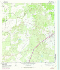
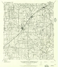
1964 Map of Moore
USGS Topo · Published 1982About this map
The town of Moore serves as the central hub of this South Texas landscape, situated along the Missouri Pacific railroad corridor. The settlement is anchored by local heritage sites such as Moore Cem and Tomlin Cem, while the surrounding terrain is defined by the winding paths of Hondo Creek and Tehuacana Creek. Fenced ranch lands, including the Gracey Ranch, characterize the rural layout, with topographic landmarks like Ghost Hill rising above the plains.
Find a feature on this map
25 named features on this map. Tap any name to fly to it.
Don’t see what you’re looking for? This feature index may not catch every label — zoom into the map to look around manually.
Map Details
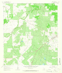
Editions of this 1964 Moore Map
2 editions found
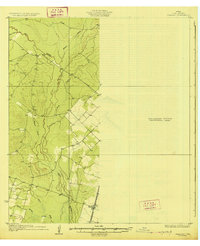
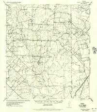
Other maps of this area

1925 · Pearsall 1-b
USGS Topo · 1:48,000
1927 · Pearsall
USGS Topo · 1:62,500
1934 · Schattel
USGS Topo · 1:62,500
1942 · Natalia
USGS Topo · 1:62,500

1953 · Crystal City
USGS Topo · 1:250,000

1954 · San Antonio
USGS Topo · 1:250,000

1955 · Crystal City
USGS Topo · 1:250,000

1957 · San Antonio
USGS Topo · 1:250,000

1961 · Crystal City
USGS Topo · 1:250,000
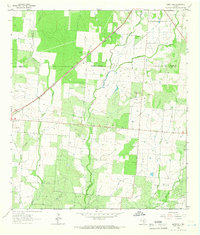
1964 · Ghost Hill
USGS Topo · 1:24,000