
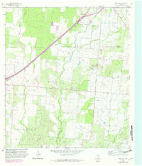
1964 Map of Ghost Hill
USGS Topo · Published 1966About this map
Energy production and cattle ranching shape the landscape of this Frio County region in the mid-1960s. The Big Foot Gas Field and Big Foot Oil Field dominate the southern portion of the sheet, marked by a dense network of pipelines and service roads. The Missouri Pacific railroad cuts a straight diagonal across the northern terrain, passing through the Medina Co Frio Co boundary and serving the localized gravel operations. Waterways such as San Miguel Creek and Chacon Creek provide the primary drainage for the area's brushy ranchlands. Genealogists will find historical markers of early settlement at Moore Cem and Longview Cem, while the singular elevation of Ghost Hill stands as a prominent local landmark amidst the rolling draws and numerous wells.
Find a feature on this map
16 named features on this map. Tap any name to fly to it.
Don’t see what you’re looking for? This feature index may not catch every label — zoom into the map to look around manually.
Map Details
Editions of this 1964 Ghost Hill Map
2 editions found
Other maps of this area

1927 · Pearsall
USGS Topo · 1:62,500

1934 · Schattel
USGS Topo · 1:62,500

1942 · Natalia
USGS Topo · 1:62,500

1953 · Crystal City
USGS Topo · 1:250,000

1954 · San Antonio
USGS Topo · 1:250,000

1955 · Crystal City
USGS Topo · 1:250,000

1957 · San Antonio
USGS Topo · 1:250,000

1961 · Crystal City
USGS Topo · 1:250,000

1964 · Devine
USGS Topo · 1:24,000
1964 · Moore
USGS Topo · 1:24,000