
1964 Map of Devine
USGS Topo · Published 1966About this map
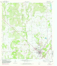
Devine serves as the primary hub of this 1960s landscape, situated at the intersection of the Missouri Pacific railroad and a network of rural roads. The town's layout includes essential community landmarks such as the High Sch, Jr High Sch, and the Athletic Field, reflecting its role as a regional center. Outside the city limits, the terrain is characterized by a series of drainages including Black Creek, Burnt Boot Creek, and San Francisco Creek, which carve through the land alongside numerous Gravel Pits.
Find a feature on this map
22 named features on this map. Tap any name to fly to it.
Don’t see what you’re looking for? This feature index may not catch every label — zoom into the map to look around manually.
Map Details
Editions of this 1964 Devine Map
2 editions found
Other maps of this area

1942 · Natalia
USGS Topo · 1:62,500

1954 · San Antonio
USGS Topo · 1:250,000

1956 · New Fountain
USGS Topo · 1:62,500

1957 · San Antonio
USGS Topo · 1:250,000

1958 · La Coste
USGS Topo · 1:24,000

1964 · Ghost Hill
USGS Topo · 1:24,000

1964 · Castroville
USGS Topo · 1:24,000
1964 · Moore
USGS Topo · 1:24,000
1964 · Lytle
USGS Topo · 1:24,000
1964 · Bigfoot
USGS Topo · 1:24,000