1927 Map of Pearsall
USGS Topo · Published 1927About this map
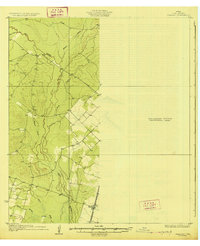
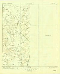
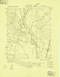
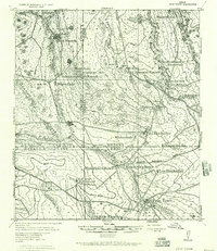
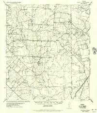
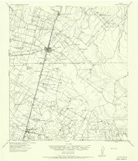
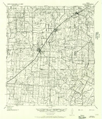
Frio River drainage and the surrounding South Texas brush country are captured here during a unique surveying transition in the late 1920s. This sheet is notable for its use of early aerial photography compiled by the Army Air Corps to supplement traditional ground survey methods. The settlement of Derby serves as a lonely rail outpost along the International Great Northern railroad, which cuts a sharp line through the landscape. To the north and west, the map details a complex network of seasonal watercourses including Hondo Creek, Buck Creek, and the Leona River. A significant portion of the eastern quadrangle is labeled as a Preliminary Edition Unsurveyed Area, reflecting the frontier nature of topographic mapping in Frio County at this time.
Find a feature on this map
10 named features on this map. Tap any name to fly to it.
Don’t see what you’re looking for? This feature index may not catch every label — zoom into the map to look around manually.
Map Details
Editions of this 1927 Pearsall Map
2 editions found
Other maps of this area

1925 · Pearsall 1-b
USGS Topo · 1:48,000
1925 · Pearsall 1-c
USGS Topo · 1:48,000
1928 · Frio Town
USGS Topo · 1:62,500
1934 · Schattel
USGS Topo · 1:62,500

1942 · Divot
USGS Topo · 1:62,500
1942 · Dilley
USGS Topo · 1:62,500
1942 · Natalia
USGS Topo · 1:62,500

1953 · Crystal City
USGS Topo · 1:250,000

1954 · San Antonio
USGS Topo · 1:250,000

1955 · Crystal City
USGS Topo · 1:250,000