1927 Map of Pearsall
USGS Topo · Published 1949About this map
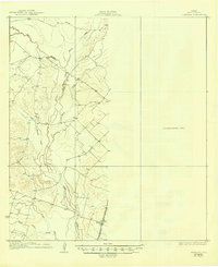
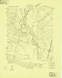
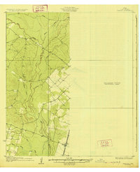
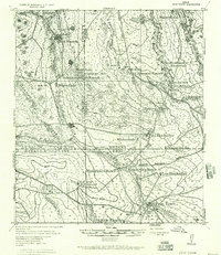
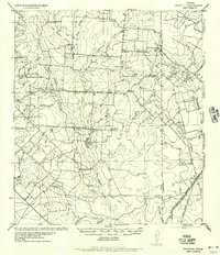
The Frio River valley south of Pearsall is defined by a dense network of braided channels and seasonal tributaries that shaped the settlement of Frio County in the 1920s. The village of Derby serves as the primary focal point of the eastern half, situated along the corridor of the International Great Northern railroad. This rail line provided a critical link for the transport of livestock and agricultural goods, paralleling the river systems that drain the landscape. To the west, the terrain is marked by the convergences of Hondo Creek, Palo Blanco Creek, and the Leona River. The eastern third of this sheet is designated as an Unsurveyed Area, leaving a stark contrast between the detailed topography of the river basins and the unmapped plains to the east, illustrating the limits of early twentieth-century geodetic field work in South Texas.
Find a feature on this map
10 named features on this map. Tap any name to fly to it.
Don’t see what you’re looking for? This feature index may not catch every label — zoom into the map to look around manually.
Map Details
Editions of this 1927 Pearsall Map
2 editions found
Other maps of this area

1925 · Pearsall 1-b
USGS Topo · 1:48,000
1925 · Pearsall 1-c
USGS Topo · 1:48,000
1927 · Pearsall
USGS Topo · 1:62,500
1928 · Frio Town
USGS Topo · 1:62,500
1934 · Schattel
USGS Topo · 1:62,500

1942 · Divot
USGS Topo · 1:62,500
1942 · Dilley
USGS Topo · 1:62,500
1942 · Natalia
USGS Topo · 1:62,500

1953 · Crystal City
USGS Topo · 1:250,000

1954 · San Antonio
USGS Topo · 1:250,000