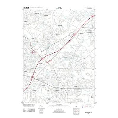
2011 Map of Moorestown
USGS Topo · Published 2011About this map
Moorestown and the suburban expanses of western New Jersey are captured here at the beginning of the 2010s. The landscape is defined by its complex hydrography, with the North Branch Pennsauken Creek and South Branch Pennsauken Creek draining toward the Delaware River, while Strawbridge Lake serves as a central landmark near the Strawbridge Lake Upper Dam. The map documents a dense network of residential developments and historic settlements, ranging from the established blocks of Maple Shade and Lenola to smaller locales like Bougher and Colemantown.
Find a feature on this map
71 named features on this map. Tap any name to fly to it.
Don’t see what you’re looking for? This feature index may not catch every label — zoom into the map to look around manually.
Map Details
Editions of this 2011 Moorestown Map
This is the sole edition of this map. No revisions or reprints were ever made.
Other maps of this area

1888 · Mount Holly
USGS Topo · 1:62,500

1890 · Burlington
USGS Topo · 1:62,500

1891 · Philadelphia
USGS Topo · 1:62,500

1893 · Germantown
USGS Topo · 1:62,500

1893 · Burlington
USGS Topo · 1:62,500

1894 · Mount Holly
USGS Topo · 1:62,500

1894 · Philadelphia
USGS Topo · 1:62,500

1894 · Germantown
USGS Topo · 1:62,500

1896 · Germantown
USGS Topo · 1:62,500

1896 · Philadelphia
USGS Topo · 1:62,500
Featured Places
- Cherry Hill Township, NJ
- Mount Laurel Township, NJ
- Willingboro Township, NJ
- Moorestown Township, NJ
- Maple Shade Township, NJ