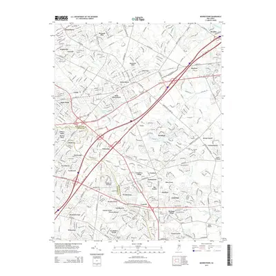
2014 Map of Moorestown
USGS Topo · Published 2014About this map
The dense suburban landscape of Moorestown and its surrounding communities in Burlington and Camden counties is defined by a intricate network of neighborhoods and historic burying grounds. Colestown Cem and Mt Laurel Cem stand as significant landmarks for genealogists, alongside smaller sites like Eldridge Cem and Mt Carmel Cem. This 2014 survey reveals the close-knit development pattern across West Moorestown and Fellowship, where residential subdivisions are intertwined with the natural drainage of the N Br Pennsauken Cr and the N Br Cooper River. Industrial and transportation corridors, most notably the New Jersey Tpke, bisect the area, contrasting with recreational spaces like Strawbridge Lake. From the established streets of Cinnaminson to the newer reaches of Greentree Village, the map documents the modern footprint of a region long shaped by its proximity to transit routes and regional water bodies.
Find a feature on this map
61 named features on this map. Tap any name to fly to it.
Don’t see what you’re looking for? This feature index may not catch every label — zoom into the map to look around manually.
Map Details
Editions of this 2014 Moorestown Map
This is the sole edition of this map. No revisions or reprints were ever made.
Other maps of this area

1888 · Mount Holly
USGS Topo · 1:62,500

1890 · Burlington
USGS Topo · 1:62,500

1891 · Philadelphia
USGS Topo · 1:62,500

1893 · Germantown
USGS Topo · 1:62,500

1893 · Burlington
USGS Topo · 1:62,500

1894 · Mount Holly
USGS Topo · 1:62,500

1894 · Philadelphia
USGS Topo · 1:62,500

1894 · Germantown
USGS Topo · 1:62,500

1896 · Germantown
USGS Topo · 1:62,500

1896 · Philadelphia
USGS Topo · 1:62,500
Featured Places
- Cherry Hill Township, NJ
- Mount Laurel Township, NJ
- Willingboro Township, NJ
- Moorestown Township, NJ
- Maple Shade Township, NJ