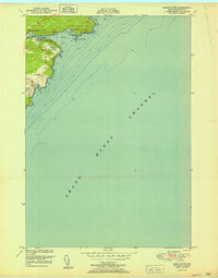
1951 Map of Moose River
USGS Topo · Published 1951About this map
The Grand Manan Channel dominates this coastal survey, where the extreme eastern edge of Maine meets the sea. The landscape is defined by the heavy presence of bogs and low-lying water, from the winding path of the Moose River to Bog Creek, Bog Brook, and Norse Pond. Settlement is sparse and concentrated along the shore, anchored by the Moose River School near the river mouth.
Find a feature on this map
14 named features on this map. Tap any name to fly to it.
Don’t see what you’re looking for? This feature index may not catch every label — zoom into the map to look around manually.
Map Details
Editions of this 1951 Moose River Map
This is the sole edition of this map. No revisions or reprints were ever made.
Other maps of this area

1907 · Eastport
USGS Topo · 1:48,000

1908 · Eastport
USGS Topo · 1:62,500

1917 · Cutler
USGS Topo · 1:62,500

1918 · Cutler
USGS Topo · 1:62,500

1943 · Eastport
USGS Topo · 1:62,500

1945 · Eastport
USGS Topo · 1:62,500

1949 · Whiting
USGS Topo · 1:24,000

1949 · West Lubec
USGS Topo · 1:24,000
1949 · Moose River
USGS Topo · 1:24,000
1949 · Lubec
USGS Topo · 1:24,000