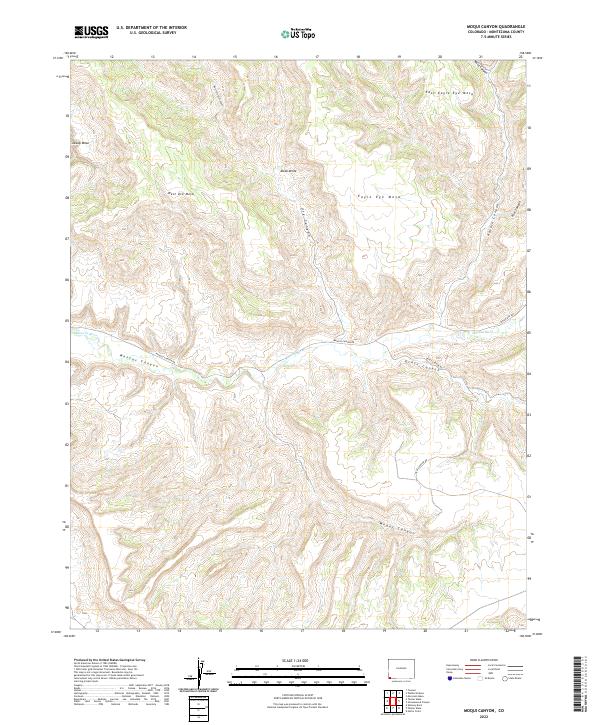
2022 Map of Moqui Canyon
USGS Topo · Published 2022About this map
Mancos River winds through the high plateau country of Montezuma County, cutting deeply through the sandstone formations of the Mesa Verde region. The topography is defined by a series of prominent flat-topped features, including Cowboy Mesa, West Ute Mesa, and Eagle Eye Mesa, separated by complex drainage systems such as Navajo Canyon and Ute Canyon. In the southern portion of the sheet, the terrain drops into Moqui Canyon and Grass Canyon, where the landscape remains largely defined by natural contours and minimal infrastructure. Transportation is restricted to a few established routes that follow the canyon floors and rim edges, specifically Mancos Canyon Rd and Indian Rte 204. This survey illustrates the intricate relationship between the region's geological structures and the limited access points into this southwestern Colorado landscape.
Find a feature on this map
21 named features on this map. Tap any name to fly to it.
Don’t see what you’re looking for? This feature index may not catch every label — zoom into the map to look around manually.
Map Details
Editions of this 2022 Moqui Canyon Map
This is the sole edition of this map. No revisions or reprints were ever made.
Other maps of this area

1889 · Chaco
USGS Topo · 1:250,000

1892 · Chaco
USGS Topo · 1:250,000

1912 · Soda Canyon
USGS Topo · 1:62,500

1915 · Soda Canyon
USGS Topo · 1:62,500

1934 · Chimney Rock
USGS Topo · 1:62,500

1936 · Chimney Rock
USGS Topo · 1:62,500

1954 · Shiprock
USGS Topo · 1:250,000

1956 · Cortez
USGS Topo · 1:250,000

1958 · Cortez
USGS Topo · 1:250,000

1958 · Shiprock
USGS Topo · 1:250,000