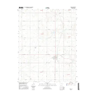
2015 Map of Moran
USGS Topo · Published 2015About this map
The town of Moran serves as the primary hub of this Allen County landscape, situated at a significant crossroads in southeast Kansas. This 2015 survey reveals an area defined by its agricultural layout, with roads named for distant states like New Hampshire Rd, Nebraska Rd, and Missouri Rd carving a neat grid across the prairie. The drainage patterns here are particularly intricate, as the map captures the divide between the S Fork Little Osage River flowing north and the Marmaton River coursing to the southeast. Local history and genealogy are anchored by Moran Cem and Golden Valley Cem, while the small settlement of Bayard remains visible in the northern reaches. The presence of Ensminger Airport and the small Katy Lake provides additional character to this rural expanse where Elm Cr and Rock Cr cut through the gently undulating terrain.
Find a feature on this map
29 named features on this map. Tap any name to fly to it.
Don’t see what you’re looking for? This feature index may not catch every label — zoom into the map to look around manually.
Map Details
Editions of this 2015 Moran Map
This is the sole edition of this map. No revisions or reprints were ever made.
Other maps of this area

1885 · Garnett
USGS Topo · 1:125,000

1886 · Iola
USGS Topo · 1:125,000

1893 · Iola
USGS Topo · 1:125,000

1894 · Garnett
USGS Topo · 1:125,000

1904 · Iola
USGS Topo · 1:125,000

1947 · Lawrence
USGS Topo · 1:250,000

1947 · Joplin
USGS Topo · 1:250,000

1949 · Joplin
USGS Topo · 1:250,000

1950 · Lawrence
USGS Topo · 1:250,000

1954 · Joplin
USGS Topo · 1:250,000