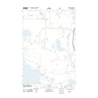
2011 Map of Moran
USGS Topo · Published 2011About this map
Moran and Allenville sit at the center of this Mackinac County landscape, serving as small hubs for the surrounding forested terrain of the Upper Peninsula. The area's communal and spiritual history is anchored by the Moran Post Office, the Brevort Township Fairground, and two local burial grounds, Immaculate Conception Cemetery and Brevort Cemetery. This map captures a diverse aquatic network where the Moran River and Pointe aux Chenes River drain toward the northern shores of Lake Michigan, specifically near Poupard Bay. Inland, the landscape is dotted with numerous bodies of water such as Hay Lake and Cranberry Lake. Recreation is represented by the Silver Mountain Downhill Ski/Tubing Hill, while local travel relies on the grid of roads including Round Lake Rd and Castle Rock Rd, which cut through the lowlands and marshy stretches characteristic of the region.
Find a feature on this map
39 named features on this map. Tap any name to fly to it.
Don’t see what you’re looking for? This feature index may not catch every label — zoom into the map to look around manually.
Map Details
Editions of this 2011 Moran Map
This is the sole edition of this map. No revisions or reprints were ever made.
Other maps of this area

1931 · St Ignace NW
USGS Topo · 1:31,680

1931 · Moran NE
USGS Topo · 1:31,680

1931 · Ozark SE
USGS Topo · 1:31,680

1948 · Moran NE
USGS Topo · 1:31,680

1948 · Moran NW
USGS Topo · 1:31,680

1954 · Sault Sainte Marie
USGS Topo · 1:250,000

1955 · Cheboygan
USGS Topo · 1:250,000

1956 · Sault Sainte Marie
USGS Topo · 1:250,000

1957 · Sault Sainte Marie
USGS Topo · 1:250,000

1958 · Cheboygan
USGS Topo · 1:250,000