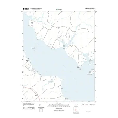
2011 Map of Morattico
USGS Topo · Published 2011About this map
The Rappahannock River defines the landscape of this coastal Virginia region, where the water has long dictated the patterns of settlement and commerce. Small communities and landings dot the shoreline, from Morattico and Simonson on the northern neck to Butylo and Bayport on the southern banks. This area is characterized by an intricate network of waterways like Farnham Creek and Morattico Creek, which carve into the land to create distinct geographic features such as Folly Neck and Curletts Point.
Find a feature on this map
63 named features on this map. Tap any name to fly to it.
Don’t see what you’re looking for? This feature index may not catch every label — zoom into the map to look around manually.
Map Details
Editions of this 2011 Morattico Map
This is the sole edition of this map. No revisions or reprints were ever made.
Other maps of this area

1917 · Urbanna
USGS Topo · 1:62,500

1917 · Morattico
USGS Topo · 1:62,500

1918 · Tappahannock
USGS Topo · 1:62,500

1918 · Morattico
USGS Topo · 1:62,500

1919 · New Kent
USGS Topo · 1:62,500

1919 · Tappahannock
USGS Topo · 1:62,500

1926 · Morattico
USGS Topo · 1:62,500

1943 · Richmond
USGS Topo · 1:250,000

1944 · Tappahannock
USGS Topo · 1:31,680

1944 · Dunnsville
USGS Topo · 1:31,680