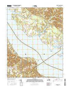
2016 Map of Morattico
USGS Topo · Published 2016About this map
The Rappahannock River serves as the central artery of this region, separating the coastal settlements of Sharps and Morattico as it flows toward the Chesapeake. Small waterfront communities like Simonson and Wildwood Beach dot the shorelines, reflecting a landscape deeply tied to the water. The interior transition from agricultural lands to tidal wetlands is marked by features like Morattico Swamp and Myrtle Swamp, while aviation history is preserved through the locations of Folly Neck Airport and Shandy Hall Farm Airport. Genealogists may find value in the specific locations of Milden Cem and Emmanuel Cem, which anchor the local hamlets. The terrain is further defined by numerous points and necks, such as Suggetts Point and Folly Neck, which have historically dictated the placement of roads and landings along these riverbanks.
Find a feature on this map
89 named features on this map. Tap any name to fly to it.
Don’t see what you’re looking for? This feature index may not catch every label — zoom into the map to look around manually.
Map Details
Editions of this 2016 Morattico Map
This is the sole edition of this map. No revisions or reprints were ever made.
Other maps of this area

1917 · Urbanna
USGS Topo · 1:62,500

1917 · Morattico
USGS Topo · 1:62,500

1918 · Tappahannock
USGS Topo · 1:62,500

1918 · Morattico
USGS Topo · 1:62,500

1919 · New Kent
USGS Topo · 1:62,500

1919 · Tappahannock
USGS Topo · 1:62,500

1926 · Morattico
USGS Topo · 1:62,500

1943 · Richmond
USGS Topo · 1:250,000

1944 · Tappahannock
USGS Topo · 1:31,680

1944 · Dunnsville
USGS Topo · 1:31,680