2023 Map of Morenci
USGS Topo · Published 2023About this map
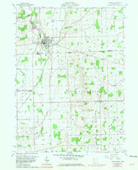
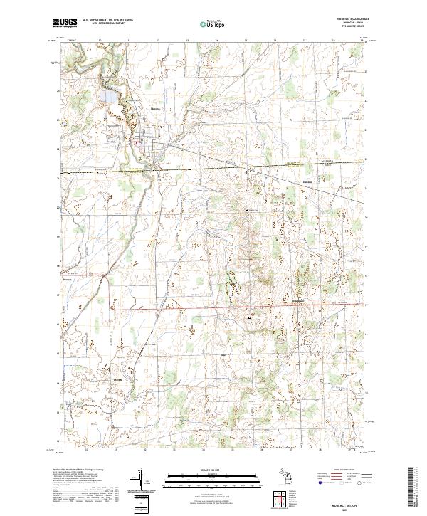
Morenci serves as the primary hub in this borderland survey, where the Michigan and Ohio state line cuts directly through the landscape. The town's grid, including W Main St and E Locust St, transitions quickly into a dense network of drainage channels and creeks that define the regional geography. Waterways such as Lime Creek and the winding Bean Creek dominate the northern terrain, while Old Bean Creek meanders through the central plains. Smaller rural nodes like Thelma, Oakshade, and Inlet are scattered across the township lines, often anchored by local landmarks such as Hawley Cem or Butler Cem. The layout of modern routes like US Rte 20 and Morenci Rd illustrates the long-standing transport corridors connecting Lenawee and Fulton counties across the state boundary.
Find a feature on this map
28 named features on this map. Tap any name to fly to it.
Don’t see what you’re looking for? This feature index may not catch every label — zoom into the map to look around manually.
Map Details
Editions of this 2023 Morenci Map
This is the sole edition of this map. No revisions or reprints were ever made.