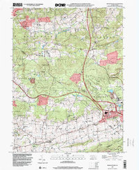
1999 Map of Morgantown
USGS Topo · Published 2001About this map
Morgantown and its surrounding tri-county landscape sit at the intersection of industry and deep-rooted rural settlement at the close of the twentieth century. The map reveals the significant footprint of the Grace Mine and the legacy of early ironworking at Joanna Furnace, which stand in contrast to the quiet hamlets of Alleghenyville and Churchtown. Large tracts of the State Game Lands No 52 dominate the center of the sheet, where the terrain transitions toward Welsh Mountain in the south.
Find a feature on this map
49 named features on this map. Tap any name to fly to it.
Don’t see what you’re looking for? This feature index may not catch every label — zoom into the map to look around manually.
Map Details
Editions of this 1999 Morgantown Map
This is the sole edition of this map. No revisions or reprints were ever made.
Other maps of this area

1894 · Reading
USGS Topo · 1:62,500

1902 · Wernersville
USGS Topo · 1:62,500

1905 · Honey Brook
USGS Topo · 1:62,500

1906 · New Holland
USGS Topo · 1:62,500

1907 · Honeybrook
USGS Topo · 1:62,500

1908 · New Holland
USGS Topo · 1:62,500

1913 · Reading
USGS Topo · 1:62,500

1915 · Reading
USGS Topo · 1:62,500

1941 · Honeybrook
USGS Topo · 1:62,500

1941 · New Holland
USGS Topo · 1:62,500
Featured Places
- East Earl Township, PA
- New Morgan, PA
- Plowville, Robeson Township
- Brecknock Township, PA
- Cumru Township, PA