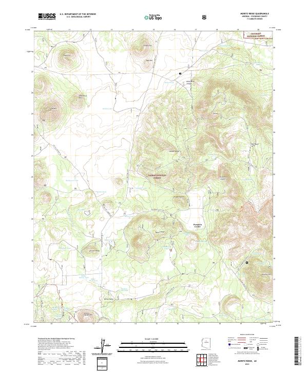
2021 Map of Moritz Ridge
USGS Topo · Published 2021About this map
Kaibab National Forest and Coconino National Forest converge on this high-altitude landscape, characterized by a complex network of volcanic hills and seasonal water catchments. The terrain is defined by prominent elevations like Potato Hill, Spud Hill, and the expansive Bull Basin Mesa, which rise above the surrounding plateaus. A significant historical element is the Beale Wagon Road Trl, a mid-19th-century wagon route that traverses the southern portion of the map, providing a tangible link to early western migration and surveying efforts. The small settlement at Pumpkin Center serves as a central landmark near Pumpkin Knoll, while numerous water tanks such as White Tank and Tiptop Tank highlight the critical role of water management for ranching and forest operations in this arid region. These features, along with ephemeral bodies like Rabbit Lake and Fay Lake, illustrate how human activity and travel routes have long been dictated by the natural topography and available resources.
Find a feature on this map
65 named features on this map. Tap any name to fly to it.
Don’t see what you’re looking for? This feature index may not catch every label — zoom into the map to look around manually.
Map Details
Editions of this 2021 Moritz Ridge Map
This is the sole edition of this map. No revisions or reprints were ever made.
Other maps of this area

1886 · San Francisco Mtns
USGS Topo · 1:250,000

1886 · Chino
USGS Topo · 1:250,000

1891 · San Francisco Mtns
USGS Topo · 1:250,000

1891 · Chino
USGS Topo · 1:250,000

1894 · San Francisco Mtns
USGS Topo · 1:250,000

1899 · San Francisco Mtns
USGS Topo · 1:250,000

1908 · Flagstaff
USGS Topo · 1:125,000

1912 · Flagstaff
USGS Topo · 1:125,000

1922 · Williams
USGS Topo · 1:125,000

1947 · Flagstaff
USGS Topo · 1:250,000