2024 Map of Morriston
USGS Topo · Published 2024About this map
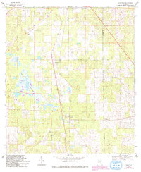
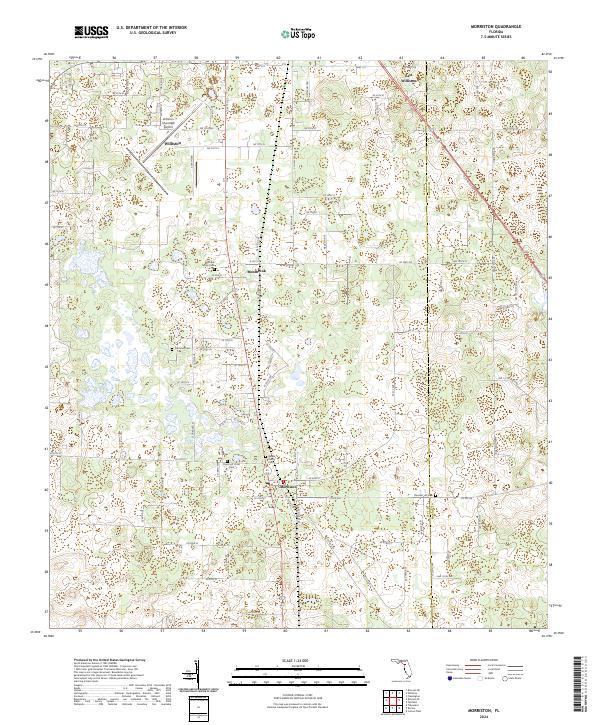
The settlement of Morriston anchors the southern portion of this landscape, situated along a north-south transit corridor that also connects Montbrook and Williston. This modern survey reveals a region defined by a high density of small, family-associated burial grounds, which suggests a deep-rooted history of rural landownership and local lineage. Notable sites include the Sistrunk Family Cem and the Barber Family Cem, alongside the Church of Christ Cem and Plummer Cem. The presence of the Williston Municipal Airport north of the main town center contrasts with the surrounding network of county roads like Old Blichton Rd. The map also captures the Levy and Marion county line, where East Williston and the Pleasant Hill Cem sit at the edge of the quadrangle.
Find a feature on this map
89 named features on this map. Tap any name to fly to it.
Don’t see what you’re looking for? This feature index may not catch every label — zoom into the map to look around manually.
Map Details
Editions of this 2024 Morriston Map
This is the sole edition of this map. No revisions or reprints were ever made.