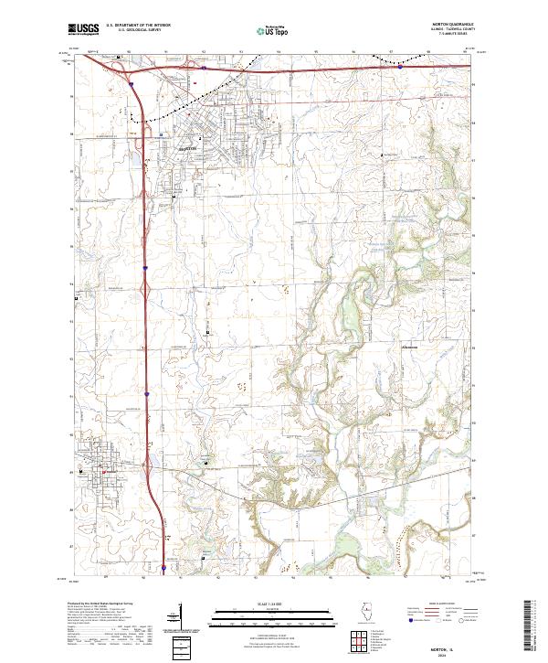
2024 Map of Morton
USGS Topo · Published 2024About this map
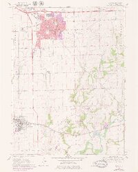
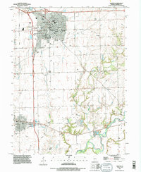
Morton serves as the central hub of this Tazewell County landscape, characterized by its grid of residential streets and essential services like the local Post Office. The area is deeply marked by its religious and pioneer heritage, evidenced by numerous burial grounds such as the Apostolic Christian Church Cem Old and the Tennessee Point Cem. These sites, along with smaller family or community plots like Winzeler Cem and Roberts Cem, provide a dense record of the region’s ancestral settlement patterns.
Find a feature on this map
138 named features on this map. Tap any name to fly to it.
Don’t see what you’re looking for? This feature index may not catch every label — zoom into the map to look around manually.
Map Details
Editions of this 2024 Morton Map
This is the sole edition of this map. No revisions or reprints were ever made.
Historical Maps of Tremont Through Time
3 maps found