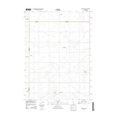
2013 Map of Mosby Butte
USGS Topo · Published 2013About this map
Great Rift volcanic features dominate this landscape along the border of Blaine County and Power County in southern Idaho. The terrain is defined by its stark geological formations, most notably the elevated landmarks of Mosby Butte and Horse Butte. This 2013 survey illustrates a high-desert environment where few human structures or roads have been established, preserving the natural topography of the eastern Snake River Plain. The map serves as a clear record of the volcanic rift zone, documenting the complex contours and the distinct boundaries between these two counties in a region characterized by its expansive, undeveloped volcanic fields.
Find a feature on this map
4 named features on this map. Tap any name to fly to it.
Don’t see what you’re looking for? This feature index may not catch every label — zoom into the map to look around manually.
Map Details
Editions of this 2013 Mosby Butte Map
This is the sole edition of this map. No revisions or reprints were ever made.
Other maps of this area

1954 · Pocatello
USGS Topo · 1:250,000

1955 · Idaho Falls
USGS Topo · 1:250,000

1958 · Idaho Falls
USGS Topo · 1:250,000

1958 · Pocatello
USGS Topo · 1:250,000

1972 · Antelope Lake
USGS Topo · 1:24,000

1972 · Split Top
USGS Topo · 1:24,000

1972 · Bear Trap Cave
USGS Topo · 1:24,000

1972 · Mule Butte
USGS Topo · 1:24,000

1972 · Mosby Well
USGS Topo · 1:24,000

1972 · Mosby Butte
USGS Topo · 1:24,000