
1954 Map of Pocatello
USGS Topo · Published 1963About this map
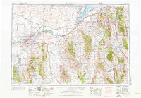
The Snake River anchors this mid-century look at Southeast Idaho, feeding into the expansive American Falls Reservoir and Lake Walcott. The landscape is a study in 1950s infrastructure and land management, dominated by the Fort Hall Indian Reservation and the sprawling reaches of the Sawtooth National Forest and Caribou National Forest. Regional transit and power are well-defined, showing the Union Pacific rail lines connecting essential stops like Kimama Station and Michaud Siding, alongside the Kenyon Power Substation. Local life centers around small hubs such as Malad City and Burley, with rural institutions like the L D S Church and Pella School providing essential community markers for genealogical research. The varied terrain, from the Lava fields to the Bannock Range, illustrates the intersection of agricultural development and protected wilderness at the Minidoka National Wildlife Refuge.
Find a feature on this map
90 named features on this map. Tap any name to fly to it.
Don’t see what you’re looking for? This feature index may not catch every label — zoom into the map to look around manually.
Map Details
Editions of this 1954 Pocatello Map
4 editions found
Other maps of this area

1914 · Logan
USGS Topo · 1:125,000

1915 · Preston
USGS Topo · 1:96,000

1916 · Logan
USGS Topo · 1:125,000

1917 · Portneuf
USGS Topo · 1:62,500

1918 · Preston
USGS Topo · 1:125,000

1918 · Paradise Valley
USGS Topo · 1:62,500

1934 · American Falls
USGS Topo · 1:62,500

1934 · Michaud
USGS Topo · 1:62,500

1934 · Rockland
USGS Topo · 1:62,500

1936 · American Falls
USGS Topo · 1:62,500