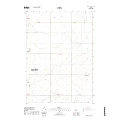
2020 Map of Mosby Butte
USGS Topo · Published 2020About this map
Craters Of The Moon National Preserve dominates this section of the Snake River Plain, where volcanic geology defines the landscape of Blaine Co and Power Co. This high-desert terrain is characterized by ancient lava flows and subterranean features like the Bear Trap Lava Tube, which underscores the geothermal history of the region. The map tracks the prominent Great Rift, a deep fracture zone in the earth's crust that cuts across the territory north of Horse Butte. Isolated volcanic landmarks such as Mosby Butte rise above the surrounding flats, providing key navigational markers in an otherwise open expanse. Apart from the historic transit line of the Minidoka To Arco Rd, the area remains largely undeveloped, preserving the raw character of this volcanic wilderness.
Find a feature on this map
7 named features on this map. Tap any name to fly to it.
Don’t see what you’re looking for? This feature index may not catch every label — zoom into the map to look around manually.
Map Details
Editions of this 2020 Mosby Butte Map
This is the sole edition of this map. No revisions or reprints were ever made.
Other maps of this area

1954 · Pocatello
USGS Topo · 1:250,000

1955 · Idaho Falls
USGS Topo · 1:250,000

1958 · Idaho Falls
USGS Topo · 1:250,000

1958 · Pocatello
USGS Topo · 1:250,000

1972 · Antelope Lake
USGS Topo · 1:24,000

1972 · Split Top
USGS Topo · 1:24,000

1972 · Bear Trap Cave
USGS Topo · 1:24,000

1972 · Mule Butte
USGS Topo · 1:24,000

1972 · Mosby Well
USGS Topo · 1:24,000

1972 · Mosby Butte
USGS Topo · 1:24,000