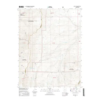
2016 Map of Mosca Pass
USGS Topo · Published 2016About this map
Mosca Pass serves as a vital geographic divide along the border of Alamosa and Huerfano counties, where the high desert meets the eastern mountain slopes. This 2016 survey highlights the dramatic transition from the Great Sand Dunes National Park and National Preserve in the west to the dense woodlands of the Rio Grande National Forest and San Isabel National Forest. Local history is embedded in the network of historic routes, including the Mosca Pass Trail and the Ute Trail, which trace ancestral paths across the Sangre de Cristo Range. The hydrological landscape is defined by the headwaters of the Huerfano River and its numerous tributaries like Rito Oso and Sheep Cr, alongside high-elevation water management sites such as Sierra Blanco Reservoir Number 2 and Montez Reservoir.
Find a feature on this map
59 named features on this map. Tap any name to fly to it.
Don’t see what you’re looking for? This feature index may not catch every label — zoom into the map to look around manually.
Map Details
Editions of this 2016 Mosca Pass Map
This is the sole edition of this map. No revisions or reprints were ever made.
Other maps of this area

1889 · Huerfano Park
USGS Topo · 1:125,000

1892 · Huerfano Park
USGS Topo · 1:125,000

1954 · Trinidad
USGS Topo · 1:250,000

1955 · Trinidad
USGS Topo · 1:250,000

1958 · Trinidad
USGS Topo · 1:250,000

1959 · Trinidad
USGS Topo · 1:250,000

1965 · Zapata Ranch
USGS Topo · 1:24,000

1965 · Twin Peaks
USGS Topo · 1:24,000

1967 · Mosca Pass
USGS Topo · 1:24,000
1967 · Blanca Peak
USGS Topo · 1:24,000