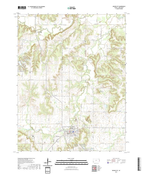
2022 Map of Mound City
USGS Topo · Published 2022About this map
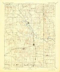
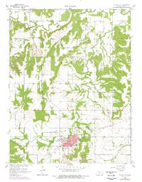
Mound City serves as the focal point of this 2022 survey, anchored by the Linn County Courthouse and a series of historic burial grounds that reflect the area's deep roots. The landscape is defined by the meandering courses of Little Sugar Creek and Big Sugar Cr, which cut through the terrain alongside smaller tributaries like Hazel Br and Turkey Cr. In the north, the small settlement of Farlinville marks the crossing of the river, while the town of Mound City to the south maintains its status as a local hub.
Find a feature on this map
54 named features on this map. Tap any name to fly to it.
Don’t see what you’re looking for? This feature index may not catch every label — zoom into the map to look around manually.
Map Details
Editions of this 2022 Mound City Map
This is the sole edition of this map. No revisions or reprints were ever made.
Historical Maps of Mound City Through Time
4 maps found