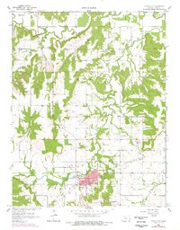
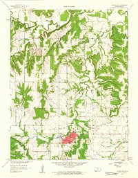
1958 Map of Mound City
USGS Topo · Published 1978About this map
Mound City serves as the focal point of this Linn County landscape, where the town's grid is established south of Little Sugar Creek. The map documents a rural environment deeply connected to the winding paths of Big Sugar Creek and Hazel Branch. Local institutions define the community's layout, from the County Fairground and High Sch in the south to the Gaging Station near Farlinville in the north.
Find a feature on this map
30 named features on this map. Tap any name to fly to it.
Don’t see what you’re looking for? This feature index may not catch every label — zoom into the map to look around manually.
Map Details
Editions of this 1958 Mound City Map
2 editions found
Other maps of this area

1887 · Mound City
USGS Topo · 1:125,000

1893 · Mound City
USGS Topo · 1:125,000

1947 · Lawrence
USGS Topo · 1:250,000

1950 · Lawrence
USGS Topo · 1:250,000

1956 · Lawrence
USGS Topo · 1:250,000
1957 · Boicourt
USGS Topo · 1:24,000

1958 · La Cygne
USGS Topo · 1:24,000
1958 · Pleasanton
USGS Topo · 1:24,000
1958 · Prescott
USGS Topo · 1:24,000
1958 · Mound City
USGS Topo · 1:24,000