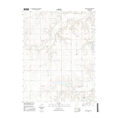
2015 Map of Mound City NW
USGS Topo · Published 2015About this map
The confluence of the N Fork Little Sugar Cr and S Fork Little Sugar Cr near the settlement of Critzer defines the hydraulic character of this Linn County landscape. Situated northwest of the town of Mound City, this area is marked by a network of drainage systems including Big Sugar Creek and Coffeebean Cr that carve through the prairie terrain. The map records several vital local landmarks for family historians, notably the Centerville Cem in the northwest and the Wesley Chapel and its associated Wesley Chapel Cem further south. The eastern edge of the quadrangle shows the residential development around Lake Chaparral, contrasting with the surrounding rural sections. This survey preserves the exact placement of numerous family-named roads and rural connectors like Gorman Rd and Faucett Rd as they existed in the mid-2010s.
Find a feature on this map
57 named features on this map. Tap any name to fly to it.
Don’t see what you’re looking for? This feature index may not catch every label — zoom into the map to look around manually.
Map Details
Editions of this 2015 Mound City NW Map
This is the sole edition of this map. No revisions or reprints were ever made.
Other maps of this area

1885 · Garnett
USGS Topo · 1:125,000

1887 · Mound City
USGS Topo · 1:125,000

1893 · Mound City
USGS Topo · 1:125,000

1894 · Garnett
USGS Topo · 1:125,000

1947 · Lawrence
USGS Topo · 1:250,000

1950 · Lawrence
USGS Topo · 1:250,000

1956 · Lawrence
USGS Topo · 1:250,000

1958 · La Cygne
USGS Topo · 1:24,000
1958 · Mound City
USGS Topo · 1:24,000
1958 · Mantey
USGS Topo · 1:24,000