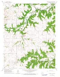
1966 Map of Mound City NW
USGS Topo · Published 1967About this map
Big Sugar Creek and Little Sugar Creek meander through this rural Linn County landscape, defining the topography of Centerville, Paris, and Mound City townships in the mid-1960s. The settlement of Critzer sits near the southern edge, positioned along a marked Grade and the Missouri - Kansas - Texas railroad line. Local industry is evident through an Oil Field, scattered Gas Wells, and a Quarry, reflecting the extraction economy of the period.
Find a feature on this map
25 named features on this map. Tap any name to fly to it.
Don’t see what you’re looking for? This feature index may not catch every label — zoom into the map to look around manually.
Map Details
Editions of this 1966 Mound City NW Map
This is the sole edition of this map. No revisions or reprints were ever made.
Other maps of this area

1885 · Garnett
USGS Topo · 1:125,000

1887 · Mound City
USGS Topo · 1:125,000

1893 · Mound City
USGS Topo · 1:125,000

1894 · Garnett
USGS Topo · 1:125,000

1947 · Lawrence
USGS Topo · 1:250,000

1950 · Lawrence
USGS Topo · 1:250,000

1956 · Lawrence
USGS Topo · 1:250,000

1958 · La Cygne
USGS Topo · 1:24,000
1958 · Mound City
USGS Topo · 1:24,000
1958 · Mantey
USGS Topo · 1:24,000