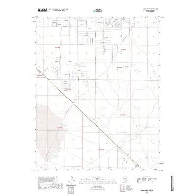
2021 Map of Mound Spring
USGS Topo · Published 2021About this map
Mound Spring and other natural water sources define the survival of this arid landscape where the Mojave Desert meets the Pahrump Valley. The map illustrates a strict rectilinear grid of desert roads and property boundaries, revealing the systematic subdivision of land even in this sparsely populated environment. Long thoroughfares like Homestead Rd, Squaw Valley Rd, and Vicki Ann Rd cross the basin, while many smaller residential streets such as Navajo Blvd and Pawnee Pl hint at modern land use planning. The diagonal survey line between the Nevada California border and the county line between Nye Co and Inyo Co cuts across the desert floor, showing how administrative boundaries intersect with the natural topography. Remote water points like Cottonwood Spring and Browns Spring remain critical landmarks amidst the desert scrub.
Find a feature on this map
94 named features on this map. Tap any name to fly to it.
Don’t see what you’re looking for? This feature index may not catch every label — zoom into the map to look around manually.
Map Details
Editions of this 2021 Mound Spring Map
This is the sole edition of this map. No revisions or reprints were ever made.
Other maps of this area

1907 · Las Vegas
USGS Topo · 1:250,000

1908 · Furnace Creek
USGS Topo · 1:250,000

1908 · Las Vegas
USGS Topo · 1:250,000

1910 · Furnace Creek
USGS Topo · 1:250,000

1910 · Ivanpah
USGS Topo · 1:250,000

1912 · Ivanpah
USGS Topo · 1:250,000

1933 · Avawatz Mountains
USGS Topo · 1:250,000

1942 · Ivanpah
USGS Topo · 1:250,000

1947 · Trona
USGS Topo · 1:250,000

1947 · Kingman
USGS Topo · 1:250,000