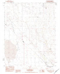
1984 Map of Mound Spring
USGS Topo · Published 1984About this map
Pahrump Valley defines this arid landscape along the Nevada and California border, where the historic Von Schmidt Line (1873) cuts diagonally across the desert floor. This 1984 provisional survey documents a sparse network of ranching and utility roads, including Hafen Ranch Road and Homestead Road, reflecting the slow expansion of settlement into the basin. Natural water sources are critical but limited features here, marked by Mound Spring and the seasonally absent Browns Spring (Dry). The presence of isolated Landing Strips suggests the region's reliance on aerial access in an era of long desert distances. This map serves as a primary record of the land's transition between the original 19th-century state boundary survey and late-20th-century development.
Find a feature on this map
13 named features on this map. Tap any name to fly to it.
Don’t see what you’re looking for? This feature index may not catch every label — zoom into the map to look around manually.
Map Details
Editions of this 1984 Mound Spring Map
This is the sole edition of this map. No revisions or reprints were ever made.
Other maps of this area

1907 · Las Vegas
USGS Topo · 1:250,000

1908 · Furnace Creek
USGS Topo · 1:250,000

1908 · Las Vegas
USGS Topo · 1:250,000

1910 · Furnace Creek
USGS Topo · 1:250,000

1910 · Ivanpah
USGS Topo · 1:250,000

1912 · Ivanpah
USGS Topo · 1:250,000

1933 · Avawatz Mountains
USGS Topo · 1:250,000

1942 · Ivanpah
USGS Topo · 1:250,000

1947 · Trona
USGS Topo · 1:250,000

1947 · Kingman
USGS Topo · 1:250,000