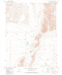
1980 Map of Mount Annie
USGS Topo · Published 1980About this map
Monte Cristo Mountains dominate the eastern landscape of this Nevada survey, rising to the peak of Mount Annie. This arid high-desert environment is defined by its water sources and geothermal activity, evidenced by Hot Well, Cold Springs, and multiple Hot Springs clusters. The boundary between Mineral and Nye Counties cuts north-to-south through a terrain marked by shifting Sand Dunes and the expansive Alkali Flat.
Find a feature on this map
21 named features on this map. Tap any name to fly to it.
Don’t see what you’re looking for? This feature index may not catch every label — zoom into the map to look around manually.
Map Details
Editions of this 1980 Mount Annie Map
This is the sole edition of this map. No revisions or reprints were ever made.
Other maps of this area

1908 · Carson Sink
USGS Topo · 1:250,000

1909 · Hawthorne
USGS Topo · 1:250,000

1910 · Carson Sink
USGS Topo · 1:250,000

1911 · Hawthorne
USGS Topo · 1:250,000

1915 · Hawthorne
USGS Topo · 1:250,000

1948 · Walker Lake
USGS Topo · 1:250,000

1957 · Walker Lake
USGS Topo · 1:250,000

1957 · Reno
USGS Topo · 1:250,000

1959 · Reno
USGS Topo · 1:250,000

1960 · Reno
USGS Topo · 1:250,000