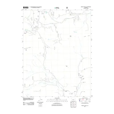
2011 Map of Mount Axtell
USGS Topo · Published 2011About this map
High-altitude mining settlements and complex hydraulic engineering define this 2011 survey of the West Elk Mountains. The historical town sites of Irwin and Ruby sit near the northern boundary, supported by a density of claims including the Forest Queen Mine and Keystone Mine. This area serves as a significant drainage hub, where Coal Creek and Ohio Creek begin their descent from the peaks. To the south, the settlement of Baldwin acts as a gateway to an extensive network of extractive operations such as the Black Diamond Mine and New Baldwin Mine.
Find a feature on this map
52 named features on this map. Tap any name to fly to it.
Don’t see what you’re looking for? This feature index may not catch every label — zoom into the map to look around manually.
Map Details
Editions of this 2011 Mount Axtell Map
This is the sole edition of this map. No revisions or reprints were ever made.
Other maps of this area

1888 · Crested Butte
USGS Topo · 1:62,500

1888 · Anthracite
USGS Topo · 1:62,500

1889 · Crested Butte
USGS Topo · 1:62,500

1889 · Anthracite
USGS Topo · 1:62,500

1893 · Anthracite
USGS Topo · 1:62,500

1893 · Crested Butte
USGS Topo · 1:62,500

1894 · Anthracite
USGS Topo · 1:62,500

1956 · Montrose
USGS Topo · 1:250,000

1959 · Montrose
USGS Topo · 1:250,000

1960 · Montrose
USGS Topo · 1:250,000