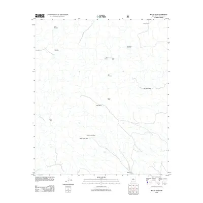
2012 Map of Mount Baldy
USGS Topo · Published 2012About this map
Old Isaacs Place and other family-named ranching outposts characterize this high-desert landscape in Hidalgo County. The terrain is defined by prominent peaks including Eagle Mountain, Pyramid Mountain, and Mount Baldy, which overlook a network of seasonal drainages such as Wolf Canyon and Ray Canyon. The settlement pattern is sparse, reflecting the ranching heritage of the region with scattered locations like Mills Goat Ranch and Shorty Millers Lower Ranch. Water sources were critical to these operations, as evidenced by Maverick Spring located near the Shorty Miller mine site. County roads such as Co RD-c007 and Co RD-c028 provide the primary transit through the undulating landscape, connecting isolated homesteads like Eaton Place and the tiered Upper Lovett Place and Lower Lovett Place near the southern settlement of Lovett.
Find a feature on this map
21 named features on this map. Tap any name to fly to it.
Don’t see what you’re looking for? This feature index may not catch every label — zoom into the map to look around manually.
Map Details
Editions of this 2012 Mount Baldy Map
This is the sole edition of this map. No revisions or reprints were ever made.
Other maps of this area

1917 · Chiricahua
USGS Topo · 1:125,000

1918 · Animas Peak
USGS Topo · 1:62,500

1918 · Pratt
USGS Topo · 1:62,500

1919 · Pratt
USGS Topo · 1:62,500

1919 · Chiricahua
USGS Topo · 1:125,000

1920 · Animas Peak
USGS Topo · 1:62,500

1926 · Rodeo
USGS Topo · 1:62,500

1940 · Apache
USGS Topo · 1:62,500

1955 · Douglas
USGS Topo · 1:250,000

1958 · Apache
USGS Topo · 1:62,500