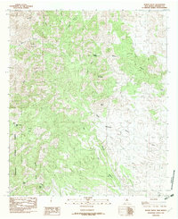
1982 Map of Mount Baldy
USGS Topo · Published 1982About this map
Coronado National Forest defines the western expanse of this Peloncillo Mountains landscape in the early 1980s. The terrain is characterized by a dense network of high peaks and drainage systems, anchored by the prominent Mount Baldy and Baldy Mountain. Water sources in this arid environment are meticulously charted, showing established infrastructure like Slover Tank and Warner Tank, alongside natural features such as Maverick Spring and the curiously named The Seep. The presence of Post Office Canyon and Horse Camp Draw suggests a history of human activity and travel through these high passes, while peaks like Pyramid Mountain and Eagle Mountain provide distinct navigational landmarks for this corner of Hidalgo County.
Find a feature on this map
26 named features on this map. Tap any name to fly to it.
Don’t see what you’re looking for? This feature index may not catch every label — zoom into the map to look around manually.
Map Details
Editions of this 1982 Mount Baldy Map
This is the sole edition of this map. No revisions or reprints were ever made.
Other maps of this area

1917 · Chiricahua
USGS Topo · 1:125,000

1918 · Animas Peak
USGS Topo · 1:62,500

1918 · Pratt
USGS Topo · 1:62,500

1919 · Pratt
USGS Topo · 1:62,500

1919 · Chiricahua
USGS Topo · 1:125,000

1920 · Animas Peak
USGS Topo · 1:62,500

1926 · Rodeo
USGS Topo · 1:62,500

1940 · Apache
USGS Topo · 1:62,500

1955 · Douglas
USGS Topo · 1:250,000

1958 · Apache
USGS Topo · 1:62,500