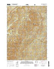
2017 Map of Mount Bolivar
USGS Topo · Published 2017About this map
Mount Bolivar stands at the intersection of Coos, Curry, and Douglas counties, serving as a primary landmark in this section of the Siskiyou National Forest. The landscape is defined by its dramatic elevation changes, characterized by peaks such as Diamond Peak and August Knob. A network of Bureau of Land Management forest roads, including BLM Rd 32-9-7 and BLM Rd 32-9-3, provides access to the high plateaus and creek valleys. Notable open areas like Big Prairie, Ashur Flat, and Walker Prairie provide geographical relief within the heavily wooded terrain. Water sources are abundant, with springs such as Bolivar Spring and Cold Spring feeding into the tributaries of the S Fork Coquille River and the complex drainage of Mule Cr. The mapping also details specific topographical features like Anaktuvuk Saddle and the Saddle Peaks, which highlight the area's difficult navigation and ridge-line patterns.
Find a feature on this map
67 named features on this map. Tap any name to fly to it.
Don’t see what you’re looking for? This feature index may not catch every label — zoom into the map to look around manually.
Map Details
Editions of this 2017 Mount Bolivar Map
This is the sole edition of this map. No revisions or reprints were ever made.
Other maps of this area

1946 · Galice
USGS Topo · 1:62,500

1946 · Dutchman Butte
USGS Topo · 1:62,500

1948 · Galice
USGS Topo · 1:62,500

1948 · Dutchman Butte
USGS Topo · 1:62,500

1954 · Bone Mountain
USGS Topo · 1:62,500

1954 · Marial
USGS Topo · 1:62,500

1955 · Medford
USGS Topo · 1:250,000

1957 · Medford
USGS Topo · 1:250,000

1958 · Medford
USGS Topo · 1:250,000
1989 · Marial
USGS Topo · 1:24,000