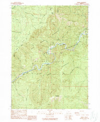
1989 Map of Marial
USGS Topo · Published 1989About this map
Marial and the nearby Rogue River Ranch serve as small human outposts in a landscape dominated by the dramatic canyon of the Rogue River. This late 1980s survey documents a corridor preserved within the Siskiyou National Forest and the Rogue Wilderness, where the river's character is defined by a succession of challenging whitewater features. Navigational landmarks like Blossom Bar Rapids, Devils Stairs, and Tichenor Riffle indicate the complex hydrology that has historically dictated travel through this corridor. The terrain is notably steep, rising from the riverbanks to summits such as Mule Mountain and Bobs Garden Mountain. Cultural and recreational access is centered on the Rogue River National Scenic Trail, which threads past Tucker Flat Camp and high-elevation overlooks like Inspiration Point and Pinnacle Point. The map also captures the confluence of numerous tributaries, including Mule Creek and Panther Creek, which carve deep side canyons into the Devils Backbone and Panther Ridge.
Find a feature on this map
54 named features on this map. Tap any name to fly to it.
Don’t see what you’re looking for? This feature index may not catch every label — zoom into the map to look around manually.
Map Details
Editions of this 1989 Marial Map
This is the sole edition of this map. No revisions or reprints were ever made.
Other maps of this area

1899 · Port Orford
USGS Topo · 1:125,000

1903 · Port Orford
USGS Topo · 1:125,000

1954 · Coos Bay
USGS Topo · 1:250,000

1954 · Bone Mountain
USGS Topo · 1:62,500

1954 · Marial
USGS Topo · 1:62,500

1954 · Agness
USGS Topo · 1:62,500

1954 · Powers
USGS Topo · 1:62,500

1955 · Medford
USGS Topo · 1:250,000

1957 · Medford
USGS Topo · 1:250,000

1958 · Medford
USGS Topo · 1:250,000