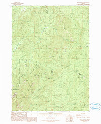
1990 Map of Mount Bolivar
USGS Topo · Published 1990About this map
The Siskiyou National Forest dominates this 1990 survey, where the convergence of Coos, Douglas, and Curry counties meets in a landscape of high peaks and deep drainages. Mining activity is evident through the presence of the Fuller Mine and Bolivar Mine, located near the headwaters of Fuller Creek. These small-scale operations sit within a complex network of wilderness areas, including the Bolivar Wilderness and the Rogue River Wilderness.
Find a feature on this map
36 named features on this map. Tap any name to fly to it.
Don’t see what you’re looking for? This feature index may not catch every label — zoom into the map to look around manually.
Map Details
Editions of this 1990 Mount Bolivar Map
This is the sole edition of this map. No revisions or reprints were ever made.
Other maps of this area

1946 · Galice
USGS Topo · 1:62,500

1946 · Dutchman Butte
USGS Topo · 1:62,500

1948 · Galice
USGS Topo · 1:62,500

1948 · Dutchman Butte
USGS Topo · 1:62,500

1954 · Bone Mountain
USGS Topo · 1:62,500

1954 · Marial
USGS Topo · 1:62,500

1955 · Medford
USGS Topo · 1:250,000

1957 · Medford
USGS Topo · 1:250,000

1958 · Medford
USGS Topo · 1:250,000
1989 · Marial
USGS Topo · 1:24,000