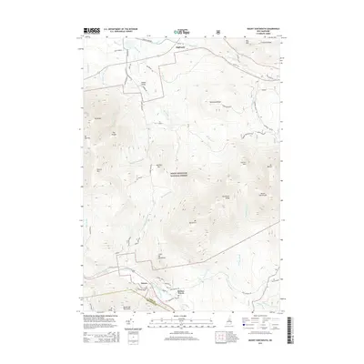
2015 Map of Mount Dartmouth
USGS Topo · Published 2015About this map
The southern gateway to the White Mountain National Forest is anchored by the historic resort areas of Bretton Woods and Fabyan, where the Ammonoosuc River carves through the high terrain. This 2015 study traces the complex drainage networks of the Dartmouth Range and the Rosebrook Mountains, illustrating a landscape where infrastructure is concentrated in the river valleys while the interior peaks remain largely roadless. In the north, the small settlement of Highlands sits near the Israel River, a contrast to the dense mountain blocks of Mount Dartmouth and Mt Deception to the south.
Find a feature on this map
62 named features on this map. Tap any name to fly to it.
Don’t see what you’re looking for? This feature index may not catch every label — zoom into the map to look around manually.
Map Details
Editions of this 2015 Mount Dartmouth Map
This is the sole edition of this map. No revisions or reprints were ever made.
Other maps of this area

1893 · Mt. Washington
USGS Topo · 1:62,500

1895 · Crawford Notch
USGS Topo · 1:62,500

1896 · Mt. Washington
USGS Topo · 1:62,500

1896 · Crawford Notch
USGS Topo · 1:62,500

1900 · Whitefield
USGS Topo · 1:62,500

1929 · Franconia
USGS Topo · 1:62,500

1932 · Franconia
USGS Topo · 1:62,500

1935 · Whitefield
USGS Topo · 1:48,000

1935 · Mt. Washington
USGS Topo · 1:62,500
1938 · Mt. Washington
USGS Topo · 1:62,500