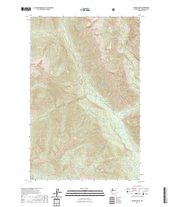
2023 Map of Mount David
USGS Topo · Published 2023About this map
Mt David and Mt Jonathan anchor this high-elevation landscape within the Glacier Peak Wilderness and the Wenatchee National Forest. The drainage patterns of the White River and the Napeequa River dominate the topography, with the White River Falls marking a significant descent in the central valley. The map documents a primitive transportation network consisting of several established backcountry paths, including the White River Trl and the Mount David Trl, which navigate the steep ascents of the White Mountains and Wenatchee Ridge. Small alpine features like Lake Elsey and the Indian Ponds are tucked into the high basins, while numerous seasonal and perennial flows such as Panther Creek and Canyon Creek carve deep into the slopes. This survey provides a contemporary record of the protected wilderness areas, showing the exact relationship between the named peaks and the riparian corridors that define the Cascades' interior.
Find a feature on this map
30 named features on this map. Tap any name to fly to it.
Don’t see what you’re looking for? This feature index may not catch every label — zoom into the map to look around manually.
Map Details
Editions of this 2023 Mount David Map
This is the sole edition of this map. No revisions or reprints were ever made.
Other maps of this area

1899 · Glacier Peak
USGS Topo · 1:125,000

1901 · Glacier Peak
USGS Topo · 1:125,000

1901 · Chiwaukum
USGS Topo · 1:125,000

1902 · Skykomish
USGS Topo · 1:125,000

1902 · Stehekin
USGS Topo · 1:125,000

1904 · Stehekin
USGS Topo · 1:125,000

1904 · Chiwaukum
USGS Topo · 1:125,000

1905 · Skykomish
USGS Topo · 1:125,000

1944 · Holden
USGS Topo · 1:62,500

1949 · Holden
USGS Topo · 1:62,500