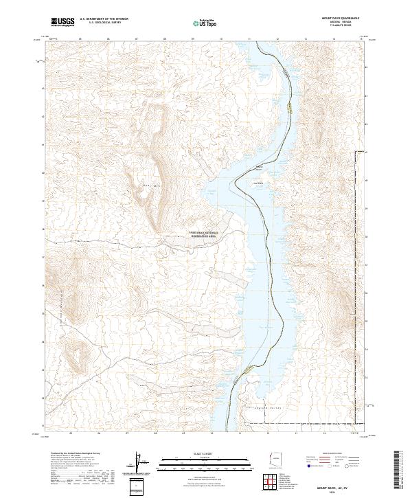
2021 Map of Mount Davis
USGS Topo · Published 2021About this map
Lake Mohave dominates this Colorado River landscape, straddling the border between Arizona and Nevada. The reservoir is surrounded by the Lake Mead National Recreation Area, where the rugged topography of the Eldorado Mountains and Opal Mtn meets the eastern edge of the Mojave Desert. This modern survey reveals a shoreline deeply serrated by dozens of named inlets, including Jeff Davis Cove, Arizona Bay, and Gold Spike Cove.
Find a feature on this map
45 named features on this map. Tap any name to fly to it.
Don’t see what you’re looking for? This feature index may not catch every label — zoom into the map to look around manually.
Map Details
Editions of this 2021 Mount Davis Map
This is the sole edition of this map. No revisions or reprints were ever made.
Other maps of this area

1886 · Camp Mohave
USGS Topo · 1:250,000

1892 · Camp Mohave
USGS Topo · 1:250,000

1926 · Nelson
USGS Topo · 1:96,000

1926 · Mohave City
USGS Topo · 1:96,000

1942 · Camp Mohave
USGS Topo · 1:250,000

1947 · Kingman
USGS Topo · 1:250,000

1948 · Kingman
USGS Topo · 1:250,000

1954 · Kingman
USGS Topo · 1:250,000

1955 · Kingman
USGS Topo · 1:250,000

1958 · Kingman
USGS Topo · 1:250,000