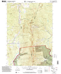
1997 Map of Mount Ellen
USGS Topo · Published 2000About this map
Huntington River flows through a landscape defined by the spine of the Green Mountains, where the high ridges of Mount Ellen and Molly Stark Mountain separate the rural communities of Hanksville, Jerusalem, and Downingville. This era reflects the established winter sports industry, with the Mad River Glen Ski Area and Mt Ellen At Sugarbush Ski Area marking the steep slopes of the eastern flank. The Long Trail follows the high drainage divide, connecting peaks such as Nancy Hanks Peak and Cutts Peak. Local heritage is anchored by small rural burial grounds like Little Ireland Cem and Gore Cem, while the Fayston Sch serves the dispersed mountain residents. Numerous brooks, including French Brook and German Flats Brook, drain these heights into the surrounding valleys, illustrating the classic Vermont pattern of narrow hill farms and upland forests.
Find a feature on this map
59 named features on this map. Tap any name to fly to it.
Don’t see what you’re looking for? This feature index may not catch every label — zoom into the map to look around manually.
Map Details
Editions of this 1997 Mount Ellen Map
This is the sole edition of this map. No revisions or reprints were ever made.
Other maps of this area

1903 · Middlebury
USGS Topo · 1:62,500

1905 · Middlebury
USGS Topo · 1:62,500

1906 · Burlington
USGS Topo · 1:62,500

1919 · Burlington
USGS Topo · 1:62,500

1919 · Lincoln Mountain
USGS Topo · 1:62,500

1920 · Lincoln Mountain
USGS Topo · 1:48,000

1920 · Middlebury
USGS Topo · 1:62,500

1921 · Richmond
USGS Topo · 1:48,000

1921 · Lincoln Mountain
USGS Topo · 1:62,500

1924 · Camels Hump
USGS Topo · 1:62,500